


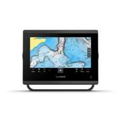


Garmin GPSMAP 743 GN+ Chartplotter
Original price was: $309.00.$95.99Current price is: $95.99.
- Quality products, fair prices.
- Safe Payments for a Better Shopping Experience
- SSL encryption, absolutely safe shopping
- Buy quality, buy with us.

7-Inch Network Chartplotter with Garmin Navionics+ Charts
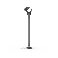
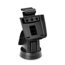
The GPSMAP 743 from Garmin with 7” touchscreen display and 10Hz GPS/GLONASS/GALILEO internal antenna quickly and efficiently connects to satellites ensuring you lock into position sooner and your map updates quicker – no more waiting on delayed map redraws. Sunlight readability and visibility from any angle the GPSMAP 743 features edge-to edge glass with a smaller footprint, and includes both flush or bracket mount options with the included kits.
Display:
A crisp 1024×600 resolution and WSVGA display, the GPSMAP 743 is a widescreen version of a typical SVGA display! Waterproof to IPX7 standards and fully customizable, the 743 offers split screen options for viewing charts, optional sonar, radar, FLIR cameras and more!
Charting:
Preloaded with Garmin Navionics+ detail each 743 includes coverage for the Coastal and Inland waters throughout the US including AutoGuidance+ technology. Offering Detail-rich charts of coastal waters, lakes and rivers the built-in charting now includes auto-routing solutions giving you a suggest path to follow thru channels, inlets, marina entrances and more. (*please note, AutoGuidance is for planning purposes only and should not replace safe navigation)
Sonar Options:
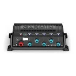
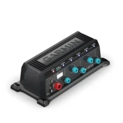
Designed as a fully functional Chartplotter the GPSMAP 743 is fully compatible with external sonar devices. Enhance your chartplotter and turn it into a full scale fishfinder system by adding any of Garmin’s GSD or GCV Sonar modules for traditional, CHIRP or clearvu and sidevu scanning sonar, as well as Garmin’s full line of Panoptix all seeing sonar systems. The GPSMAP 743 GN+ does not include an internal sounder. For sonar support, an external sounder is required, sold separately.
Network Support:
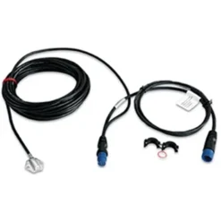
Fully Networkable, the GPSMAP 743 offers a single network port for the addition of multiple displays, Radar, Sonar, SiruisXM and more. If adding more than one network component, please note that a GMS10 port expander will be required (sold separately). In addition, the GPSMAP 743 supports both NMEA0183 and NMEA2000 (NMEA2000 starter kit required, sold separately) for connection to VHF, AIS and other NMEA communication devices.
Premium Charting Options:
The Garmin GPSMAP GN+ displays are compatible with Garmin Navionics Vision+ charts, Garmin’s premier chart offering. Garmin Navionics Vision+ charts include both coastal and lake coverage within the region of your choice. Data is sourced from Garmin and Navionics in order to provide you with exceptional detail. Regions are larger than previous charting from Garmin and provide High Resolution Relief Shading, Auto Guidance+ routing, High Resolution Satellite Imagery, Sonar Imagery, Aerial Photography, SideScan Images and 1-year of free daily updates via the Garmin ActiveCaptain app! Garmin Navionics Vision+ charts require premium content to be downloaded post purchase via the ActiveCaptain app with a compatible smartphone or tablet. All premium chart options are available in the region of your choice and sold separately.
Offering a smaller footprint, Garmin’s GPSMAP 743 sure doesn’t lack in features! If you are in the market for a 7” Multi-function display look no further than the GPSMAP 743 chartplotter with GN+ mapping!
The Garmin GPSMAP 743 GN+ Chartplotter includes preloaded Garmin Navionics+ charts for the US and Canada featuring daily chart updates, Auto-Guidance+ technology and coastal and inland coverage. The 743 chartplotter has a high resolution, 7-Inch Touch IPS display for viewability in harsh sunlight at any angle!
Be the first to review “Garmin GPSMAP 743 GN+ Chartplotter”
Related products
Marine Electronics
Marine Electronics
Marine Electronics
Marine Electronics
Marine Electronics
Marine Electronics
Marine Electronics
Marine Electronics
Reviews
There are no reviews yet.