
Sale!

Garmin Inland Lakes Boundary Waters MicroSD/SD
Original price was: $98.95.$69.27Current price is: $69.27.
- Quality products, fair prices.
- Safe Payments for a Better Shopping Experience
- SSL encryption, absolutely safe shopping
- Buy quality, buy with us.

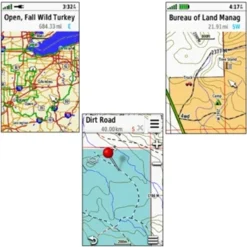
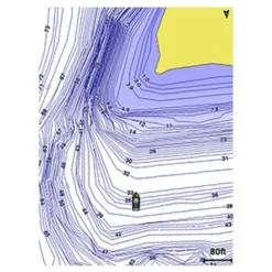
Garmin’s highly detailed inland lake and topographic maps for the Boundary Waters Canoe Area Wilderness which is located between Ontario, Canada and Minnesota on the US/Canadian border. Included Lake Maps provide detail such as creek channels, streams, fishing locations, navigational aids, wrecks and obstructions and more. Topographic maps provide 1:24,000 scale USGS Maps and 1:50,000 scale NRC (Natural Resources Canada) Maps
Compatible with:
Garmin Inland Lakes Boundary Waters MicroSD/SD
Be the first to review “Garmin Inland Lakes Boundary Waters MicroSD/SD”
Related products
Sale!
GPS Maps & Software
Original price was: $89.95.$62.97Current price is: $62.97.
Sale!
GPS Maps & Software
Original price was: $81.95.$57.37Current price is: $57.37.
Sale!
GPS Maps & Software
Original price was: $139.95.$97.99Current price is: $97.99.
Sale!
GPS Maps & Software
Original price was: $274.95.$96.99Current price is: $96.99.
Sale!
GPS Maps & Software
Original price was: $358.00.$99.99Current price is: $99.99.
Sale!
GPS Maps & Software
Original price was: $99.95.$69.97Current price is: $69.97.
Sale!
GPS Maps & Software
Original price was: $274.95.$96.99Current price is: $96.99.
Sale!
GPS Maps & Software
Original price was: $119.95.$83.97Current price is: $83.97.
Reviews
There are no reviews yet.